OHV & ATV Trails Near Cass, Arkansas
Two Ozark National Forest MVUM trail systems. One base camp. Less than 10 minutes from active riding in either direction.
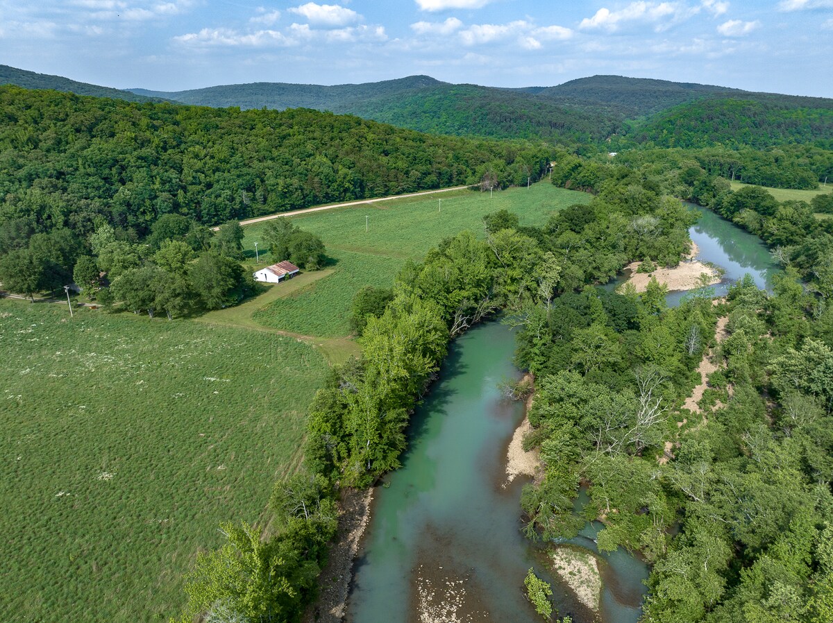
The Mulberry River Valley is one of Arkansas’ best-kept OHV secrets. Two separate Motor Vehicle Use Map (MVUM) trail systems flank the valley — Boston Mountain to the west, Pleasant Hill to the east — plus a major private riding park at Byrd’s Adventure Center. The Cass House is located on Hwy 215, between both trail systems — less than 10 minutes from active riding.
Overview: OHV Riding in the Ozark National Forest
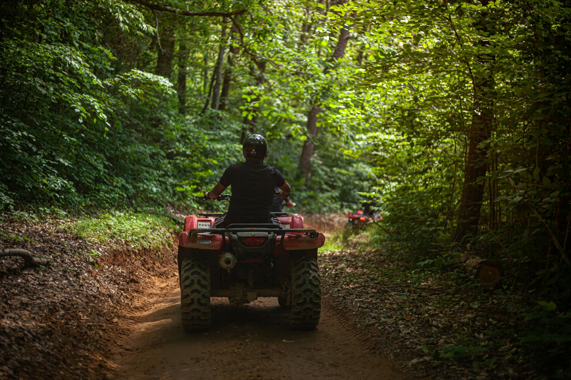
The Ozark National Forest manages hundreds of miles of roads and trails open to motorized vehicles through the Motor Vehicle Use Map (MVUM) system. The MVUM shows exactly where OHVs, ATVs, motorcycles, and 4WDs are permitted — which roads are open, which are restricted, and which trails are designated for off-highway use. Riding outside MVUM-designated areas is a federal violation. Get the map. It’s the single most important thing you can bring.
The terrain here is the Arkansas Ozarks at their best: sandstone ridges, creek drainages, hardwood forest, and enough elevation change to make it interesting. Rocky, rooted terrain throughout — significant elevation change on both systems, creek crossings (depth varies dramatically by season), and generally excellent drainage after rain compared to clay-heavy systems elsewhere.
Trail System 1: Boston Mountain MVUM
Ranger District: Boston Mountain | Location: West of Cass, toward Mill Creek OHV Area | Best for: Intermediate to advanced riders; technical terrain
The Boston Mountain section of the Ozark National Forest is the highest and roughest part of the Ozarks. The OHV network here reflects that — it’s more rugged, more technical in places, and more rewarding for riders who want to earn their miles.
Mill Creek OHV Area
Mill Creek is the hub of Boston Mountain riding. The staging area provides parking for trucks and trailers and serves as the entry point for the designated OHV network. From here, trails fan out into the forest in multiple directions.
What to Expect
- Rocky, technical sections — especially on tighter trails
- Creek crossings significant in spring; shallow or dry in summer
- Ridge-top runs with views into hollows below
- Long loops combining forest roads with ORV routes
Skill Level Breakdown
- Beginners: Stick to the main forest roads (F-roads) — wide, graded, manageable
- Intermediate: ORV-designated routes offer genuine terrain challenge
- Advanced: Tighter trail segments, rocky creek crossings, technical climbs
Vehicle types: Full-size ATVs, UTVs (side-by-sides), 4WD trucks, and dual-sport/dirt motorcycles. Narrow single-track sections limit where larger UTVs can go — check the MVUM for width restrictions.
Trail System 2: Pleasant Hill MVUM
Ranger District: Pleasant Hill | Location: East of Cass | Best for: All skill levels; families; beginners; UTVs; those wanting to cover miles
The Pleasant Hill Ranger District trail network is more accessible and less technical than the Boston Mountain system — broader forest roads, more gradual terrain, and a network that rewards exploration over raw technical ability.
What to Expect
- Extensive network of forest roads and designated ORV routes
- Lower overall technical difficulty — good for beginners
- More open terrain, good visibility, less technical overhead
- Can connect to longer routes for full day trips
Best For
- Beginners/Families: Wide, navigable, forgiving main routes
- Intermediate: Enough variety for a full day of engagement
- Large UTVs and side-by-sides needing wider routes
- Riders who want to cover significant ground
Byrd’s Adventure Center — Private OHV Park
~4 miles from Cass House — In addition to the national forest systems, Byrd’s Adventure Center operates 800 acres of private OHV trails, mud pits, and obstacle courses. The original ATV park in Arkansas since 1982. Ideal for days when you want a managed, obstacle-focused experience or groups where some riders want mud pits and challenges.
What to Bring — OHV Riding Checklist
Documents & Maps
- Motor Vehicle Use Map (MVUM) — buy at Turner Bend
- Vehicle registration and proof of insurance
- Arkansas ORV registration if required
Safety Gear
- Helmet (required for riders under 18; strongly recommended for everyone)
- Eye protection
- Gloves
- Over-the-ankle boots
- Long pants and sleeves
- First aid kit
Vehicle Prep
- Full tank of fuel (fill at Turner Bend before heading out)
- Tire repair kit / plug kit
- Tow strap
- Tool kit (basic wrenches, zip ties, electrical tape)
- Air compressor or CO2 inflator
Communication & Provisions
- Downloaded offline maps (Gaia GPS, onX Offroad) — download BEFORE leaving cell service
- Charged phone + battery bank
- Water — more than you think
- Snacks and lunch (or grab deli food at Turner Bend)
- Rain gear (Ozark weather changes fast)
Rules & Regulations
- Ride only on designated roads and trails shown on the MVUM
- Stay on designated routes — no cross-country travel
- All state vehicle registration and equipment laws apply
- No riding in wilderness areas, on trails marked “Hiker/Horse Only,” or on closed roads
- Helmets required for riders under 18 per Arkansas law
- No permit required for national forest roads and trails — Byrd’s charges a day-use fee for private property
Best Seasons for OHV Riding
| Season | Conditions | Notes |
|---|---|---|
| March–May | Good to excellent — trails drying out, mild temps | Watch for muddy spots early spring; excellent by April–May |
| June–July | Warm to hot — trails in good shape | Start early, expect heat; carry extra water |
| August | Hot; can be dry/dusty | Early mornings are best |
| September–October | Excellent — best of the year | Cooler temps, fall foliage, firm trails. Book early. |
| November | Good — uncrowded, cool | Weather can turn; check forecast |
| December–February | Variable | Can be excellent or closed by ice/snow; check conditions before traveling |
Our pick: Late September through early November is the sweet spot — cool temperatures, fall color, dry trails, and fewer crowds than peak summer weekends.
Where to Fuel Up & Get Provisions
Turner Bend Outfitters (~3 miles, Hwy 23/Pig Trail junction) — Premium gasoline, ATV/OHV maps (MVUM for both districts), deli sandwiches, beer, water, snacks, trail provisions, and camping supplies. This is your stop. Fill tanks, buy your maps, grab your lunch, and go. They know the trails and can give you current conditions.

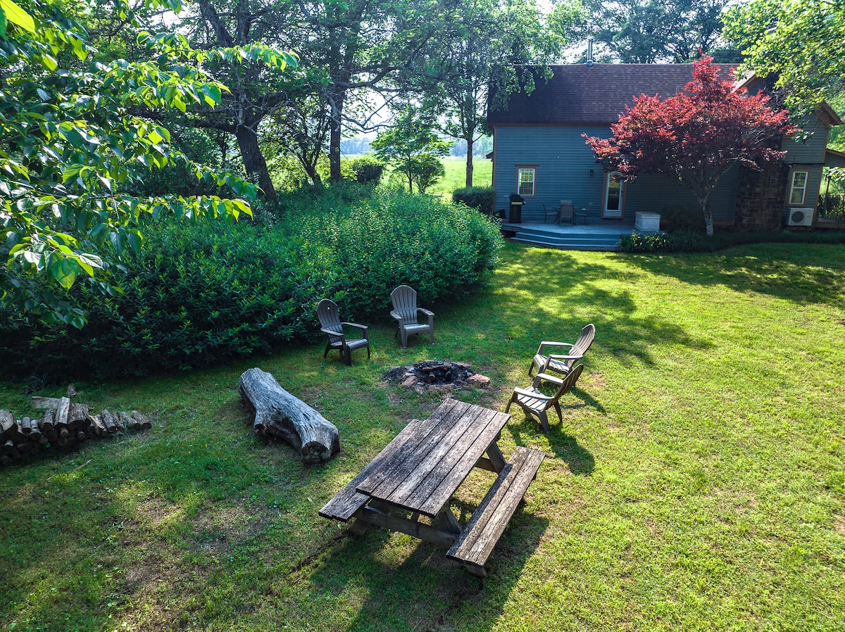
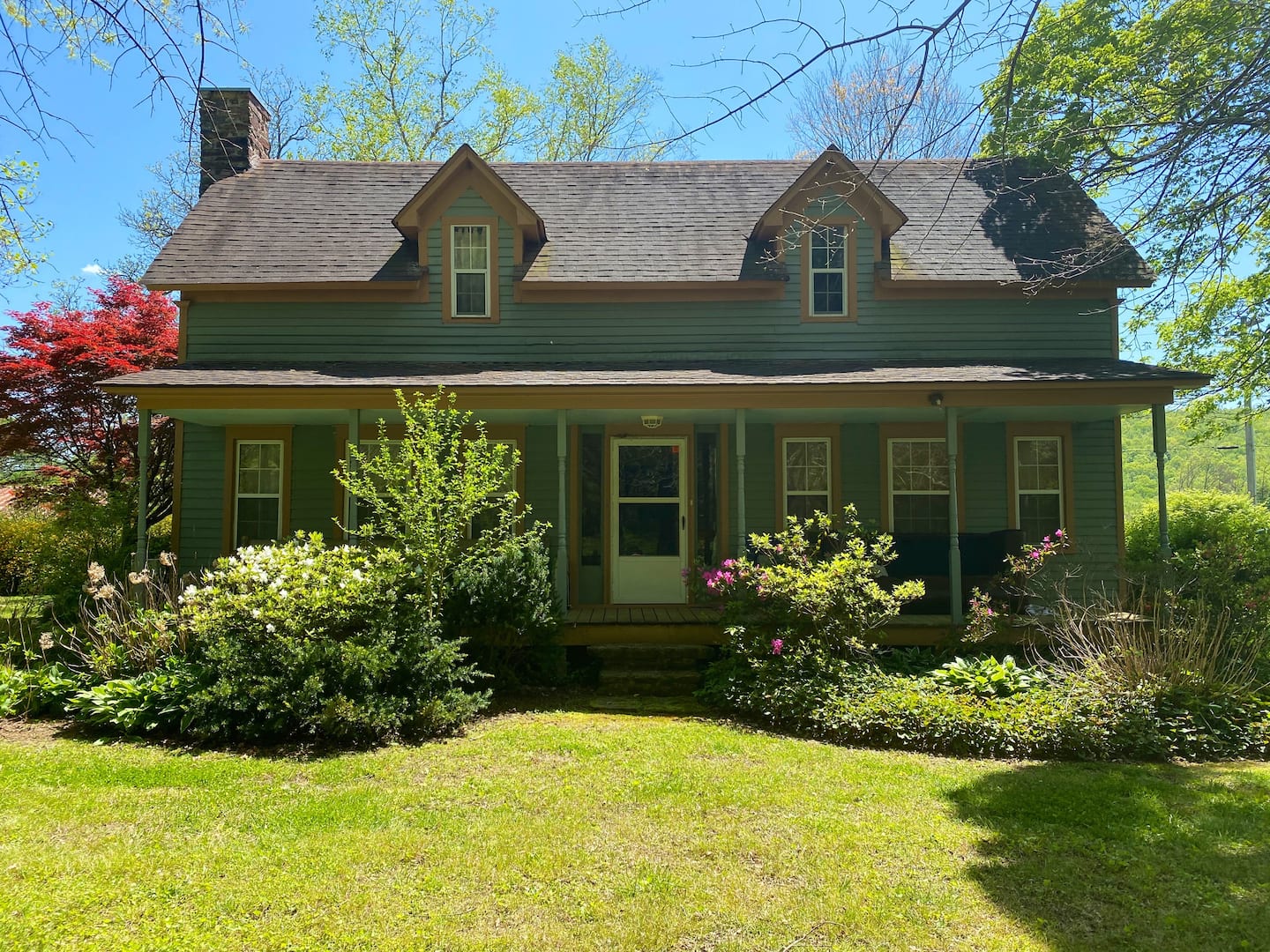
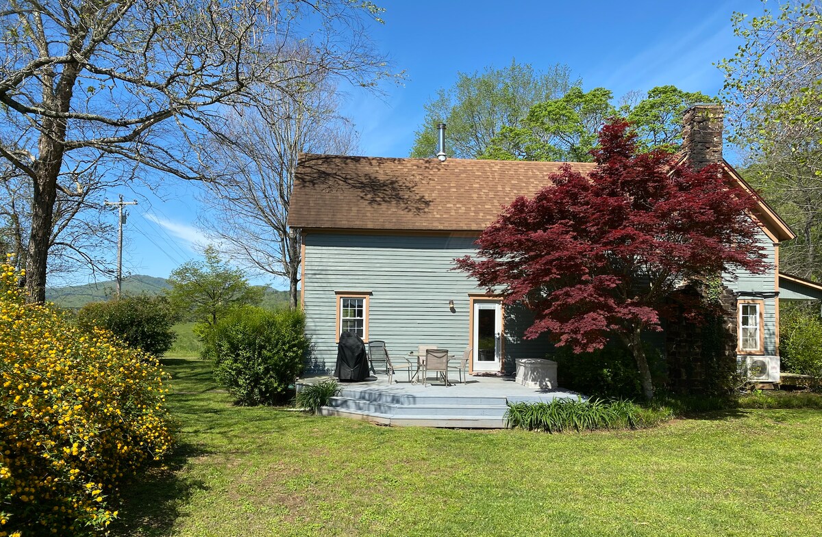
Why the Cass House Is the Right Base Camp
- Kitchen: Cook your own food, save money, eat what you want at the end of the day
- Space: 10 acres to park your trailer, spread your gear, and not feel packed in
- Location: On Hwy 215 between both trail systems — less than 10 minutes either direction
- Beds: Real beds, real showers, real sleep — which matters when you’re planning multiple riding days
- River: The Mulberry River is 100 yards away for evening cooldown swims
There’s no better pivot point for a multi-day OHV trip in this valley.